What Happened
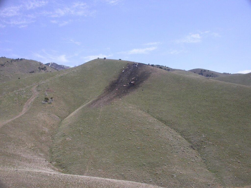
On April 25, 2009, at approximately 10:04 in the morning mountain daylight time, a Lockheed P2V-7 Neptune, registration N442NA, flew into a grassy 20-degree ridgeline about one and a half miles north of Stockton, Utah, at an elevation of 5,630 feet. The two airline transport pilots and their passenger were killed on impact. The airplane, owned and operated by Neptune Aviation Services and designated Tanker 42, was conducting a repositioning flight from Missoula, Montana, to Alamogordo, New Mexico, under Title 14 CFR Part 91 as a public use operation. No FAA flight plan had been filed. The airplane carried no retardant. The crew never saw the ridge coming.
The backstory matters here. Tanker 42 had been on its Mandatory Availability Period since April 15, committed to the government for wildfire suppression. On the evening of April 24, Neptune Aviation Services got the call: the National Interagency Coordination Center was sending them south to fight the Four Mile Fire near Dunken, New Mexico. The needed arrival time in Alamogordo was 1300 the following afternoon. That gave the crew a comfortable window. The flight distance from Missoula to Alamogordo is roughly 900 miles, and the P2V-7 cruises in the 200-knot range. Plenty of time, as long as the weather cooperated.
The First Officer had tried to file a VFR flight plan the night before through DUAT, but the system rejected the entry because it didn’t recognize the aircraft type code he entered. So the next morning, at 0601, he called the FAA’s Automated Flight Service Station for a weather briefing. During that call, he told the briefer the flight would be IFR. He was simultaneously logged into DUAT pulling a plain low-altitude weather briefing. The briefer covered it all: an AIRMET for mountain obscuration over northern Utah, another for icing from the freezing level to 20,000 feet, moderate turbulence below 15,000 feet, and a stationary front draped across northern Utah just south of where they’d be flying. Winds at 12,000 feet near Salt Lake City were forecast from 230 degrees at 38 knots. The DUAT routing the First Officer specified ran through Pocatello and Grand Junction rather than Cedar City, which meant no METARs or TAFs for Utah airports were included in that briefing. Despite telling the AFSS briefer the flight would be IFR, no IFR flight plan was ever filed with the FAA. No VFR flight plan either. The crew had a company flight plan on file with NICC, and that was it.
Tanker 42 departed Missoula at 0803. The GPS and automatic flight following data paint a clear picture of what happened over the next two hours. After climbing out to the southeast, the crew leveled at 11,500 feet MSL and held that altitude for over an hour, tracking south-southeast across Idaho. Around 0932, about four miles south of the Idaho-Utah border, they began descending. The weather ahead was building, and the crew was trying to stay underneath it. By 0940 they were through 7,600 feet and turning right to about 220 degrees. They checked in with Salt Lake ARTCC and advised they were descending to remain VFR. Salt Lake Center told them to maintain VFR and gave them the altimeter setting of 29.78. That was the last navigational anchor the crew got from ATC.
Over the next 20 minutes, the crew continued working their way down and around the weather. The CVR, which captured the last 31 minutes of the flight, tells the story through the Captain’s running commentary. He was calling out landmarks, referencing the Garmin GPS unit’s XM weather overlay, and directing the First Officer in small heading and altitude adjustments. “Go down to six point five.” “Bear left a little bit.” “Pointing right at some yellow.” “If you want, you can go down to six thousand.” The First Officer was flying the airplane and responding, mostly with one-word acknowledgments. “Okay.” “Alright.” “Okay.”
Around 0950, Salt Lake Center terminated radar service. The controller explained that the next sector couldn’t see them for about 20 miles and told them to squawk VFR and try Salt Lake Approach in 20 miles on 124.9. Tanker 42 acknowledged. That was the last radio contact with any FAA facility. At that moment the crew was over the middle of the Great Salt Lake, level at 6,500 feet, heading roughly south.
Over the next several minutes, the crew continued descending. By the time they were five miles south of the lake near Grantsville, they were at about 5,800 feet, roughly 1,400 feet above the ground. The Captain was navigating by visual reference, calling out the incinerator near Grantsville, noting Antelope Island’s position, and using Interstate 80 and then State Highway 38 as ground references. At 0954:10, the First Officer said something that should have stopped the whole conversation: “Okay, there’s some terrain comin’ up ahead; is that six ah gunna make it. I can see, just barely see it now.” The Captain did not respond. About 40 seconds later the Captain made an unrelated comment about their position relative to a VOR. The First Officer never raised the terrain question again.
The Tooele Valley Airport AWOS, located about seven and a half miles north of the accident site at an elevation of 4,321 feet, had reported a broken ceiling at 1,500 feet and an overcast at 1,900 feet at 0955. Witnesses within a mile of the impact site described ceilings of about 200 feet above their locations, which were themselves 430 to 480 feet lower than the ridgeline. Visibility at the accident site was one-quarter mile or less, rain and fog. The ridge the crew was flying toward is 5,867 feet above sea level. The terrain east of Highway 38 rises steeply and continuously. The airplane was at 5,670 feet when it crossed the highway at 10:02:40. At almost exactly 10:04, still in a nearly wings-level attitude with a very gradual nose-up pitch developing over the final eight seconds, N442NA flew into the northwest face of the ridge at 5,630 feet, about 240 feet below the ridgeline’s top. Neither pilot made any verbal indication of seeing the terrain. There was no abrupt pitch or roll input. The recording terminated six seconds after the First Officer responded “Yup” to the Captain’s last course correction.
Investigation Findings
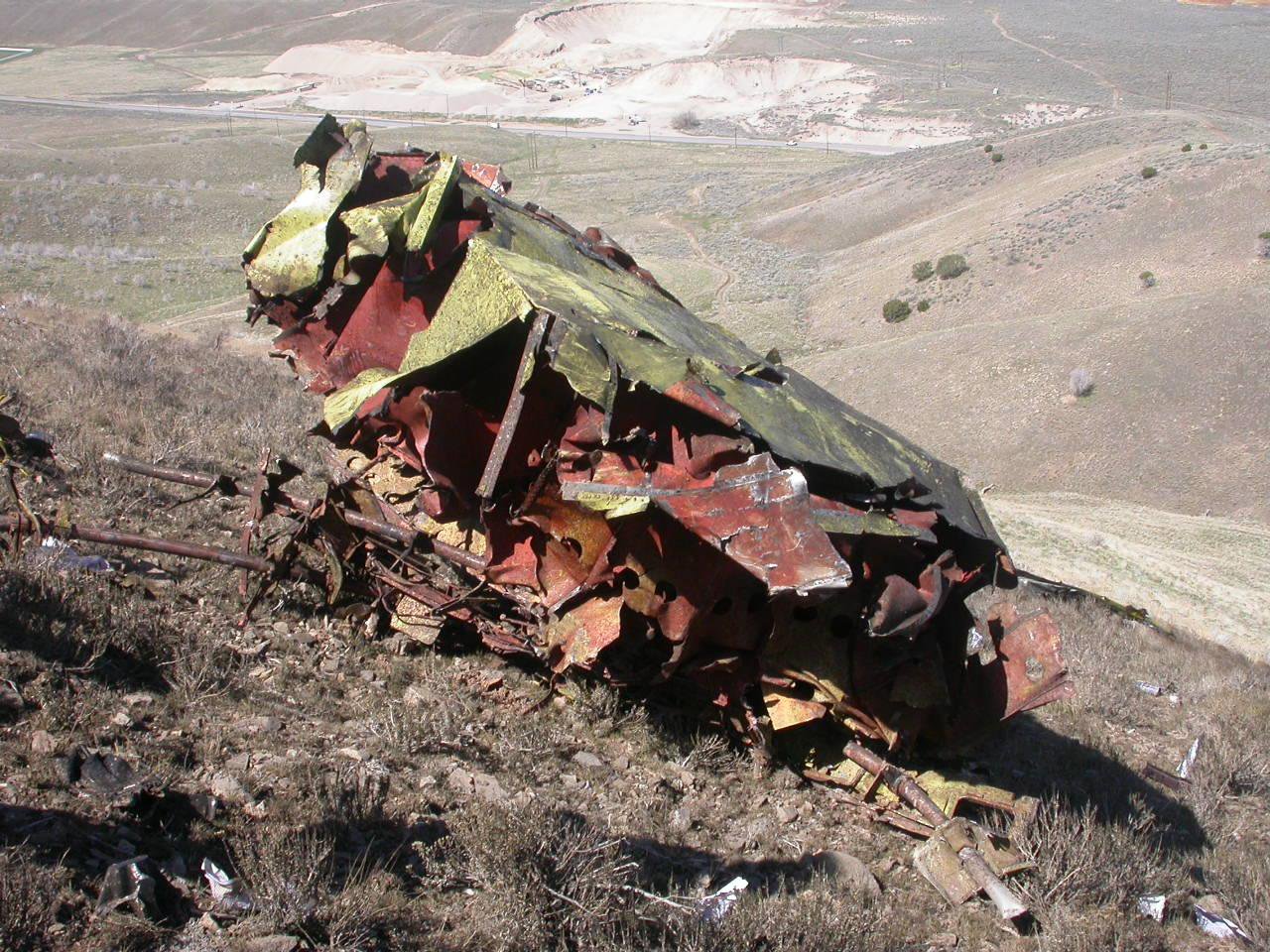
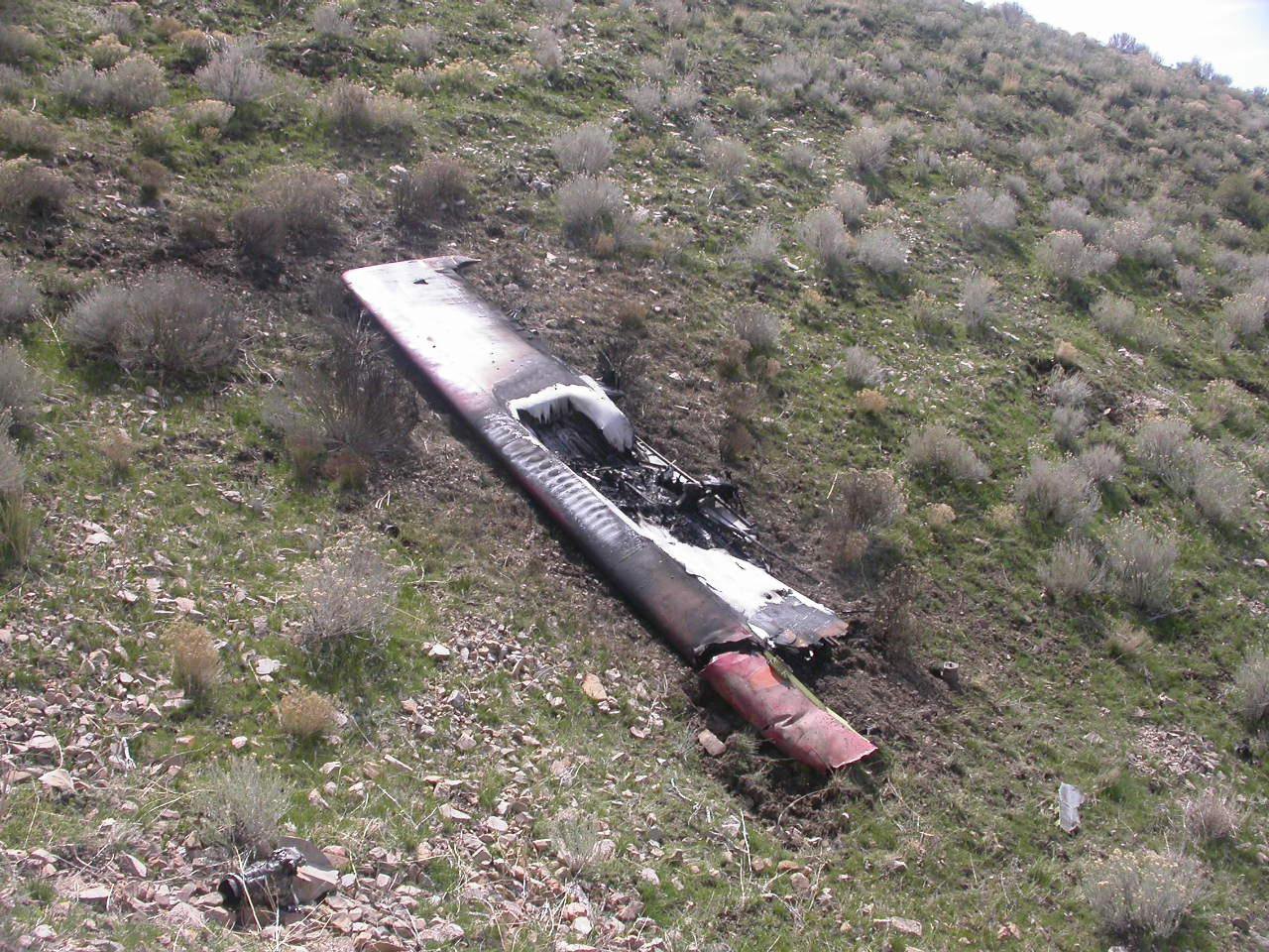
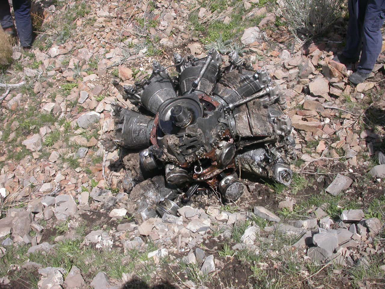
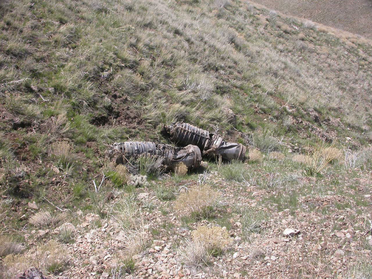
The wreckage trail ran 465 feet up the ridgeline on a magnetic heading of about 138 degrees from the initial impact point, which was marked by five ground scars in rocky soil consistent with the bottom of the fuselage and both reciprocating engine chin cowls striking simultaneously. The propeller blade slash marks measured 64 inches apart at both engines, consistent with the propellers turning at power. The propeller blades showed massive leading-edge crushing, with the leading edges pushed back two to four inches into the body of the blade across their entire spans. The jet engine throttles were confirmed in the OFF position based on the fuel valve positions found in the wreckage. Both jet engines showed no evidence of power production at impact, which was consistent with the crew’s normal practice of using only the reciprocating engines during cruise. There was no evidence of any mechanical malfunction or flight control anomaly prior to impact. The airplane hit the terrain fully controllable and under power.
The cockpit voice recorder captured 31 minutes of audio. What stands out in the transcript is not what was said, but the rhythm of the conversation. The Captain was doing almost all the talking. He was calling weather, calling landmarks, making altitude and heading decisions, and directing the First Officer in each small adjustment. The First Officer’s responses were almost entirely single-word acknowledgments. When the First Officer raised the terrain clearance question at 0954, it was the only substantive navigational concern he voiced in the entire recording. The Captain didn’t answer it. The First Officer didn’t press it. Nine minutes and fifty seconds later, the recording stopped. The NTSB noted that the CVR contained no exclamation, warning, or oral noise consistent with either crewmember seeing the terrain before impact, and the onboard accelerometer data showed no rapid pitch or roll response in the final seconds.
The weather briefing picture deserves examination on its own. The First Officer had told the AFSS briefer the flight would be IFR, and the briefing he received was comprehensive regarding hazards: mountain obscuration, icing, turbulence, a stalled frontal system over the area. But the DUAT routing he specified bypassed Utah METARs entirely. No terminal weather for Tooele, Salt Lake City, or any Utah reporting station was included in his DUAT package. The only Utah-relevant data in that briefing was the Salt Lake City winds aloft forecast. The crew then flew a VFR flight through conditions that multiple AIRMETs had explicitly flagged as containing instrument meteorological conditions. The airplane was certified for IFR flight per the February 2009 maintenance work order. The crew held instrument ratings. No IFR flight plan was ever filed.
NTSB Probable Cause
The flight crew’s failure to maintain terrain clearance during low altitude flight in low ceiling and visibility conditions. Contributing to the accident was the flight crew’s failure to adequately monitor their location with respect to the rising terrain environment ahead, and, their lack of crew resource management communication as a crew.
Safety Lessons
Three separate threads ran through this accident, and any one of them, pulled differently, might have changed the outcome. None of them required exceptional skill. All of them required a decision.
- A question about terrain is not a rhetorical question. At 0954:10, the First Officer said he could see terrain ahead and asked whether 6,000 feet was going to clear it. That question deserved an answer, a map check, or a climb. It got silence. And after the silence, the First Officer let it go. In a two-pilot cockpit, raising a safety concern is the beginning of a conversation, not the end of one. If the person you asked doesn’t respond, you ask again. You don’t file it under “probably fine.” The NTSB identified the lack of CRM communication as a contributing cause for exactly this reason: one pilot saw a problem, mentioned it once, and then deferred to the silence of the other.
- Scud running in mountainous terrain has a compounding problem that flat-country flying doesn’t. When the crew crossed the south shore of the Great Salt Lake, they were about 1,400 feet above the ground and the ground was nearly flat. That felt like margin. But the terrain east of the valley doesn’t announce itself. The Oquirrh Mountains and the ridgelines south of Tooele rise steeply and continuously, and at one-quarter mile visibility in rain and low overcast, 1,400 feet above a flat valley floor becomes zero feet above a ridge in a matter of seconds. The Captain’s running commentary about landmarks and the GPS weather overlay reflects someone who was managing the situation in his head, but the critical variable he was not tracking out loud was the elevation of the terrain ahead relative to his altitude. The XM weather overlay on the Garmin 396 shows precipitation. It does not show terrain elevation.
- Filing IFR when you have an IFR-capable airplane and an instrument rating is not a bureaucratic formality. Tanker 42 was certified for IFR. Both pilots held instrument ratings with logged actual IMC time. The weather briefing explicitly included AIRMETs for mountain obscuration and IFR conditions over the region they were flying through. The First Officer even told the AFSS briefer the flight would be IFR. But no IFR flight plan was ever filed. An IFR clearance would have provided a known terrain-safe altitude structure, positive radar contact, and a controller who was accountable for their separation from the rocks. Flying VFR into a forecast area of mountain obscuration in an airplane that is equipped and legal for IFR flight is a trade of real protection for the illusion of flexibility.
Frequently Asked Questions
Q: What is CFIT and how did it apply to the Tanker 42 accident?
A: Controlled flight into terrain, or CFIT, describes an accident in which an airworthy aircraft under crew control flies into the ground, water, or an obstacle without the crew recognizing the hazard in time to avoid it. In the Tanker 42 accident, N442NA was fully controllable and producing power when it struck the ridgeline north of Stockton, Utah. The crew was navigating by visual reference in deteriorating visibility and did not have sufficient situational awareness of the rising terrain ahead to initiate a climb or turn before impact.
Q: Why didn’t ATC warn the crew about the terrain?
A: Salt Lake Center was providing VFR traffic advisories, not IFR separation service. Shortly before the accident, the receiving sector controller advised that he could not see Tanker 42 on radar for about 20 miles, and radar service was terminated. The crew was then instructed to contact Salt Lake Approach in 20 miles. Tanker 42 never made that call. Without an IFR flight plan and an active IFR clearance, ATC had no obligation to provide terrain separation. Minimum IFR altitudes are a function of the instrument flight rules system, and a VFR aircraft operating below those altitudes is responsible for its own terrain clearance.
Q: Did the crew know the weather was going to be this bad along the route?
A: The weather briefing the First Officer received before departure was explicit about the hazards: an AIRMET for mountain obscuration, an AIRMET for icing, moderate turbulence below 15,000 feet, and a stalled frontal system over northern Utah. The information was there. What the DUAT briefing did not include were METARs and TAFs for Utah airports, because the routing the First Officer specified in the DUAT system bypassed Utah. The crew also had access to XM satellite weather on the Garmin GPS, which showed precipitation returns, but not terrain elevation or ceiling heights.
Q: What role did crew resource management (CRM) failure play in this accident?
A: The CVR transcript shows a communication pattern where the Captain was making virtually all navigational decisions and directing the First Officer in small heading and altitude adjustments, with the First Officer responding primarily with single-word acknowledgments. When the First Officer raised the terrain clearance concern at 0954, it was the only substantive safety challenge he made in the final 31 minutes of the flight. The Captain did not respond. The First Officer did not follow up. The NTSB specifically cited the crew’s lack of CRM communication as a contributing factor, reflecting that the terrain concern was raised and then effectively abandoned without resolution.
Q: Was the Lockheed P2V-7 equipped to fly IFR?
A: Yes. The February 2009 maintenance work order for N442NA explicitly noted that the airplane was inspected and certified for flight under instrument flight rules per FAR Part 91.205(d). Both pilots held airline transport pilot certificates with instrument ratings and had logged actual instrument time. A level D simulator session covering instrument procedures had been completed just months before the accident. The equipment and qualifications for IFR flight existed. No IFR flight plan was filed on the day of the accident.