What Happened
On the evening of October 9, 2012, a Bell 407 helicopter, registered N108MF and operated by ACS Helicopters LLC, was flying through deteriorating weather over northeastern Pennsylvania when it struck trees and terrain in Coolbaugh Township. The airline transport pilot and one passenger were fatally injured. A second passenger survived with serious injuries. The flight was operating under 14 CFR Part 91 as a corporate trip, destination Westchester County Airport (HPN) in White Plains, New York. No flight plan had been filed.
The day had started early. N108MF departed Somerset Airport (SMQ) in Somerville, New Jersey at 0730, picked up four passengers at Morristown Municipal Airport (MMU) by 0830, and flew them to Camden County Airport (19N) in Berlin, New Jersey for breakfast and a round of golf. The passengers played from roughly 1030 to 1500, socialized for another hour, then returned to the aircraft. By 1630 the helicopter was southbound back toward SMQ, where it dropped one passenger at 1710. Twenty minutes later it was airborne again, this time northeast toward Elmira/Corning Regional Airport (ELM) in New York with three passengers. It arrived at ELM at 1830, another passenger deplaned, and at 1845 the pilot lifted off for what was supposed to be the final leg of the day: ELM to HPN, roughly 170 miles to the southeast, with the pilot and two remaining passengers aboard.
Sunset that evening was at 1829. The end of civil twilight was 1857. By the time N108MF left Elmira, the sun was already below the horizon and usable natural light was gone. The moon would not rise until 0140 the following morning. The flight was departing into a dark night with deteriorating weather ahead, with no flight plan filed, no instrument helicopter rating held by the pilot, and no instrument certification on the aircraft itself.
The surviving passenger described what happened after takeoff plainly: the weather “began to get worse.” The pilot told them they would not make it to HPN. The weather became “even worse,” and the pilot decided to divert toward Pocono Mountains Municipal Airport (MPO) in Mount Pocono, Pennsylvania. The passenger texted his wife. He told her they were “3 miles / 3 minutes” from MPO and were going to land there. He looked out the window. It was “misty and dusky.” The crash happened shortly after.
Two ground witnesses placed the helicopter in the final moments. A woman near Interstate 380 heard a helicopter that sounded “like it was going to land on my house” and described it as flying at a “really low altitude.” A truck driver near the Daleville exit of I-380 saw it passing over a PennDOT shed heading southbound, all lights on, at what he estimated was “at or below 200 feet off the deck.” He described the visibility as “pea soup.” The helicopter was below the fog layer, following the highway south toward MPO.
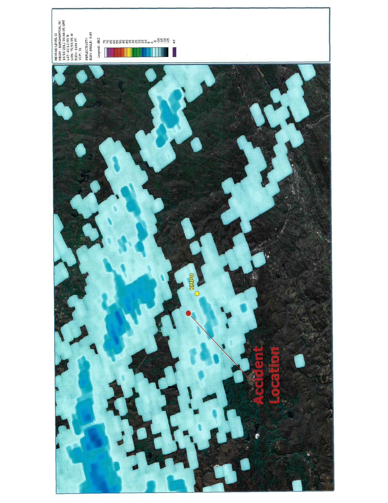
At 1953, the automated surface observation at MPO recorded wind 120 degrees at 6 knots, visibility three-quarters of a mile, light rain, mist, and a vertical visibility ceiling of 200 feet. At 2003, an overcast ceiling of 200 feet was recorded with visibility of 1.25 miles. By 2017, visibility had dropped to one-half mile with fog and a vertical visibility of 200 feet. These were low instrument flight rules conditions. Not marginal VFR. Not scud-running territory. Hard IMC.
A limousine driver waiting at HPN to collect one of the passengers received a text at 1938 saying the flight was “running late.” At 1953, another text came in telling him to go back to MMU instead. He drove to Morristown and waited. The helicopter never came.
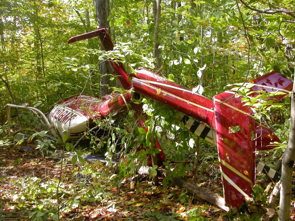
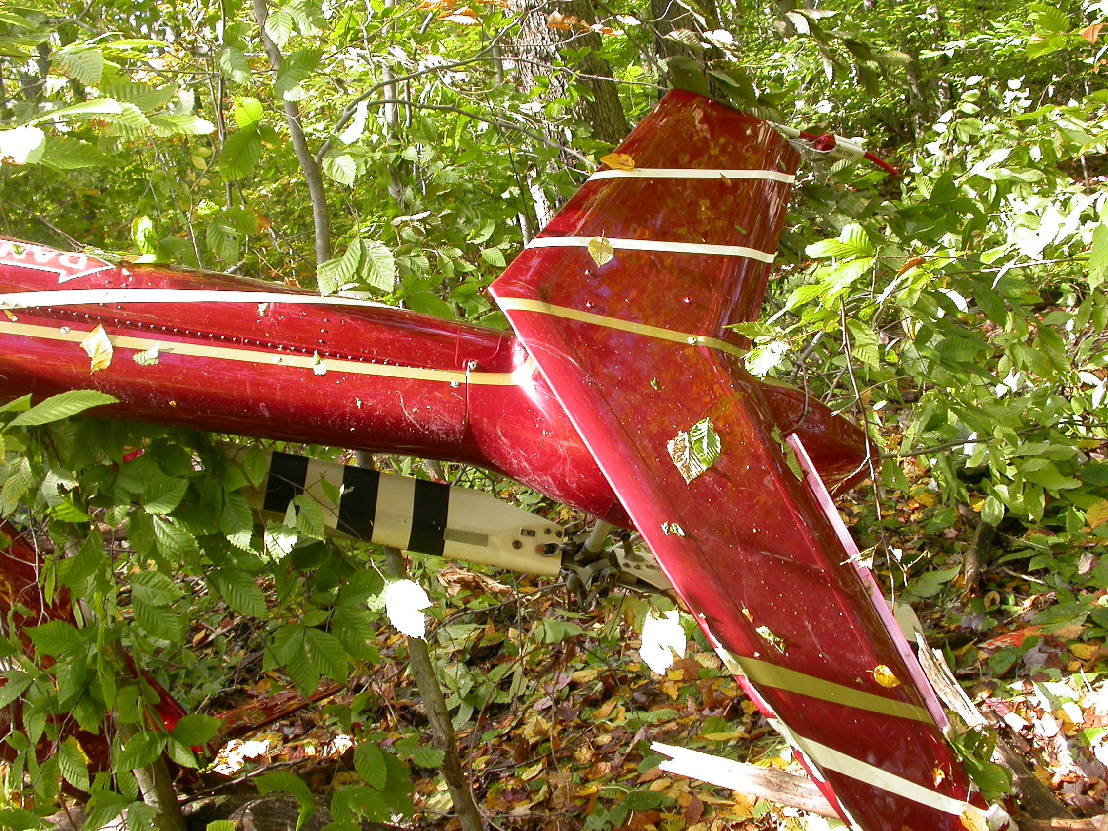
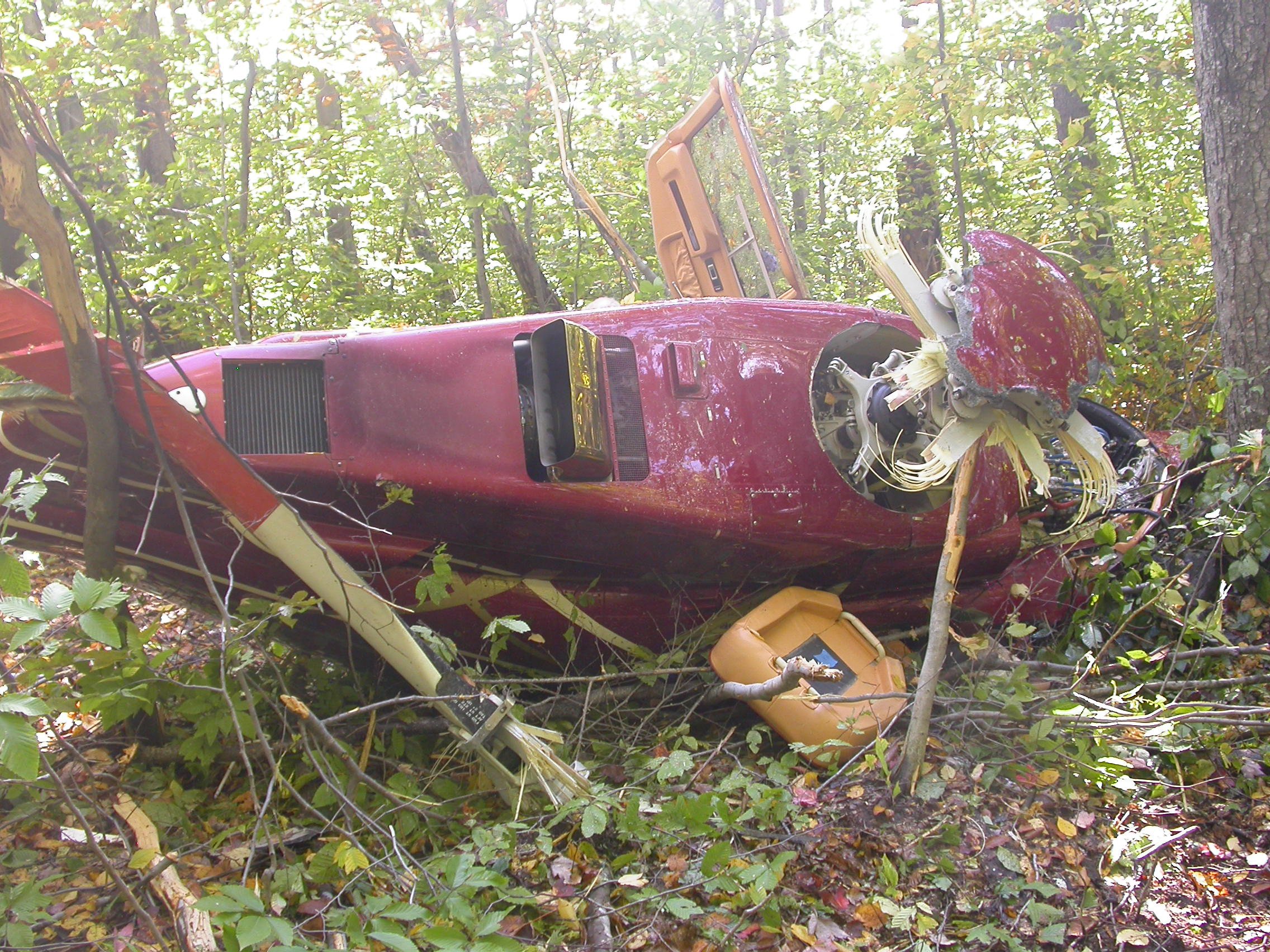
Authorities launched a search involving federal, state, and local resources. At approximately 0230 on October 10, they found N108MF in a heavily wooded area adjacent to the southbound shoulder of I-380, approximately 1.3 miles northwest of MPO. The wreckage was resting on its right side at an elevation of roughly 1,930 feet mean sea level, oriented on a magnetic heading of 254 degrees. The ground was saturated with fuel. The engine, the NTSB would later confirm, had continued running for 21 minutes after impact before the loss of oil flow eventually destroyed the turbine bearings.
Investigation Findings
The pilot’s credentials were substantial on paper. He held an airline transport pilot certificate with multi-engine land ratings, commercial single-engine land privileges, and type ratings for the ATR-42, ATR-72, CE-500, DC-9, and HS-125. He also flew as a First Officer for American Airlines. But his helicopter background told a different story. He had earned his private pilot rotorcraft-helicopter certificate in November 2009 with 77 total helicopter hours. His commercial rotorcraft certificate came in July 2010 with 202 hours. By the time of the accident, he had reported approximately 400 total helicopter hours, with around 350 of those in the Bell 407. His training at the Bell Training Academy included multiple refresher courses, the most recent completed in May 2012, five months before the crash. Critically, a review of his Bell training records found no evidence of any inadvertent IMC training or instrument flight rules helicopter training. None. And he did not hold an instrument helicopter rating. His ATP certificate authorized him to fly airplanes in IMC. It did not transfer to rotorcraft.
The Bell 407 itself was not instrument certified. The original gyroscopic instruments had been replaced with a SAGEM Integrated Cockpit Display System featuring two 10-inch LCD displays, including a primary flight display. Standby analog instruments were also installed. But the aircraft’s airworthiness certificate restricted it to day or night VFR in non-icing conditions. It could not legally fly IFR. And the ICDS data cards that could have recorded flight information turned out to be dummy cards, incapable of storing anything. The cockpit voice recorder and flight data recorder were not required by regulation, and none were installed.
The most detailed picture of the final flight came from a Garmin Aera 560 portable GPS unit found in the wreckage. It required chip-level data recovery due to impact damage, but investigators extracted 103 stored tracks containing 24,504 data points going back to August 2012. The accident flight was the last track. It ran from 19:35:21 to 20:03:24 UTC and contained 2,084 data points. On the four earlier flight legs that day, GPS altitude readings were consistent with normal cruise, with the helicopter recorded at altitudes like 2,642 feet MSL at groundspeeds around 131 knots. On the final leg, the picture changed entirely. The last recorded data point, at 20:02:36, showed the helicopter at a GPS altitude of 2,162 feet MSL and a GPS groundspeed of 31 knots, heading toward MPO, above and along Interstate 380. Thirty-one knots is barely translational flight for a helicopter. It is the speed of a pilot fighting to maintain control, not cruising.
The engine control unit recorded a sequence that told investigators what happened mechanically in the final seconds. An NP overspeed and overspeed solenoid activation occurred, consistent with sudden removal of load from the engine. An NR reduction and torque exceedance followed. These signatures are consistent with the main rotor blades striking trees and the sudden deceleration that follows. The engine itself, when examined at Rolls-Royce Indianapolis, showed no preimpact hard faults. The turbine bearing failures found during teardown were post-impact, caused by 21 minutes of operation while the aircraft lay on its side without adequate oil flow to the bearings. The engine had been running fine when it flew into those trees.
The NTSB also examined the pilot’s duty schedule at American Airlines. The day before the accident, he had reported for duty at 0810 EDT at Newark, flew a round trip to Dallas/Fort Worth totaling 7 hours and 10 minutes, and returned to Newark at 1741. He was then scheduled to sign in again the following day at 1155 EDT for another EWR-DFW-EWR round trip. That schedule created a narrow window. Getting the passengers home that night and returning before his airline report time the next morning was the only way to make both obligations work.

NTSB Probable Cause
The pilot’s decision to continue visual flight rules flight into instrument meteorological conditions due to self-imposed pressure to complete the trip, which resulted in impact with trees and terrain.
Safety Lessons
Several distinct threads ran through this accident, and each one appears independently in the record of helicopter accidents involving weather. Together they form a chain that, if broken at any link, likely changes the outcome.
- An ATP certificate does not transfer instrument privileges to rotorcraft. This pilot had 19,000 total flight hours, an ATP, and type ratings across five aircraft. In airplanes, he was fully qualified to fly in IMC. But helicopter instrument flying is a separate rating requiring separate training, and his Bell 407 records showed zero inadvertent IMC or IFR helicopter training. The aircraft’s visual scan, the control inputs required to hold attitude in IMC, the workload of managing a helicopter in the soup at night with no horizon — none of that had been practiced. Pilots who hold high-level fixed-wing credentials sometimes carry an implicit confidence that those skills transfer. In the regulatory sense and the practical sense, they do not.
- Self-imposed schedule pressure is a recognized kill chain initiator. The pilot had an airline sign-in at 1155 the following day. He had passengers who wanted to get home. He had been flying since early morning. Each of those factors individually can introduce pressure to press on. Together they built a situation where turning back or landing short felt costly, even though both options were available. The surviving passenger confirmed the pilot recognized the deteriorating weather early enough to consider HPN unreachable. That was a decision point. A precautionary landing at ELM, or any suitable field along the early portion of the route, was on the table. The helicopter had fuel. The weather window existed earlier in the flight. It closed before the pilot used it.
- Low and slow in IMC at night, over dark terrain, is unsurvivable territory. At 31 knots groundspeed and 200 feet vertical visibility over heavily wooded terrain with no moon and no discernible horizon, the pilot was operating entirely outside the performance envelope of his training and the aircraft’s certification. Following a highway at low altitude to stay under the cloud deck is a VFR technique that works in daytime with actual visual references. In the dark, with fog at 200 feet AGL, the highway disappears. The trees do not announce themselves. The GPS track captured a pilot who had slowed almost to a hover trying to find a way forward through conditions that required instrument flight to survive.
Frequently Asked Questions
Q: Did the Bell 407 have an instrument rating or IFR certification?
A: No. N108MF was certificated for day or night VFR operations only in non-icing conditions. It was not certified for IFR flight. The original gyroscopic instruments had been replaced with a SAGEM glass cockpit display system, but that modification did not change the aircraft’s VFR-only airworthiness limitation.
Q: Did the pilot hold an instrument helicopter rating?
A: No. The pilot held an airline transport pilot certificate with multi-engine airplane ratings and flew as a First Officer for American Airlines, which authorized him to fly airplanes in IMC. But he did not hold an instrument helicopter rating, and his Bell training records contained no evidence of inadvertent IMC or IFR helicopter training of any kind.
Q: What were the weather conditions at the time of the accident?
A: The automated surface observation at Pocono Mountains Municipal Airport, approximately 1.3 miles from the accident site, recorded a vertical visibility of 200 feet, visibility as low as one-half mile, light rain, and fog. These were hard instrument meteorological conditions, specifically low IFR. The accident occurred after dark with no moon, in a heavily wooded area with minimal ground lighting.
Q: Was there a mechanical failure that caused the crash?
A: No. The NTSB found no preimpact mechanical failures or malfunctions in the airframe, drivetrain, flight controls, or engine. The engine was running at the time of the tree strike and continued to operate for 21 minutes after the crash while the helicopter rested on its side. Post-impact turbine bearing failures found during the Rolls-Royce engine teardown were caused by oil starvation during that post-crash run-on period.
Q: What GPS data survived the crash and what did it show?
A: A Garmin Aera 560 portable GPS unit found in the wreckage required chip-level data recovery due to impact damage. Investigators extracted the complete accident flight track of 2,084 data points. The final recorded point, at 20:02:36 UTC, showed the helicopter at 2,162 feet GPS altitude and 31 knots groundspeed, flying along Interstate 380 toward MPO. Earlier legs that day showed cruise groundspeeds around 131 knots. The sharp contrast confirmed the helicopter was flying extremely slowly in the final moments, consistent with a pilot trying to maintain visual contact with the ground in near-zero visibility.