What Happened
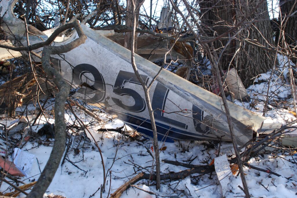
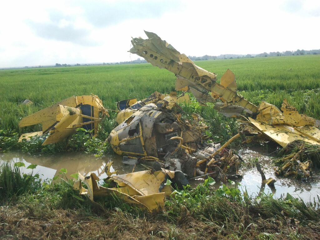
On July 26, 2011, around 0605 central daylight time, an Air Tractor AT-602, registered N8525L and owned by Sturdivant Brothers Flying Service Inc, lifted off from a private airstrip near Glendora, Mississippi, loaded and bound for a soybean field somewhere between Glendora and Drew. The pilot was 60 years old, held a commercial certificate with single-engine land privileges, and had accumulated 17,707 total flight hours. He did not hold an instrument rating. He would never return from that flight. The airplane struck a rice field approximately 7 miles east of Drew about an hour after departure, killing the pilot on impact. The airplane sustained substantial damage.
Company personnel said the pilot obtained a computer weather briefing before he left. What that briefing showed, and what he made of it, is unknowable now. What is known is that there was no record of any Flight Service Station or DUAT weather briefing request associated with the flight that morning. What is also known is that the weather was already bad when he pushed the throttle forward. Personnel at the airstrip described the conditions as cloudy. The owner of the airplane said it was a little foggy at departure. A little foggy at Glendora. About 7 miles west at Drew, at roughly 0700, a friend of the pilot spotted the Air Tractor passing overhead. That witness described the weather as very foggy. Thirteen minutes later, a plantation employee found the wreckage in a rice field. That employee reported roughly 150 feet of forward visibility. The plantation owner arrived one minute after that and described the fog as so thick you could cut it with a knife, with maybe 200 feet forward visibility.
The closest official weather reporting was at Greenwood-Leflore Airport, about 25 miles southeast of the accident site. At 0653, Greenwood was reporting an overcast ceiling of 200 feet above the ground and 5 miles visibility in mist. Thirty-four miles southwest, at Mid Delta Regional in Greenville, the 0701 observation showed a broken ceiling at 100 feet above the ground, 1.25 miles visibility in mist, and winds of 4 knots from the south. Both stations were reporting instrument meteorological conditions. The National Weather Service Area Forecast for northern Mississippi that morning had been amended by AIRMET Sierra for IFR conditions across the state. A surface-based temperature inversion to approximately 817 feet above the ground and a moist low-level environment had combined to produce the dense fog that was sitting across the entire region. GOES-13 satellite imagery at both 0645 and 0745 showed the fog and stratus extending directly over the accident site.
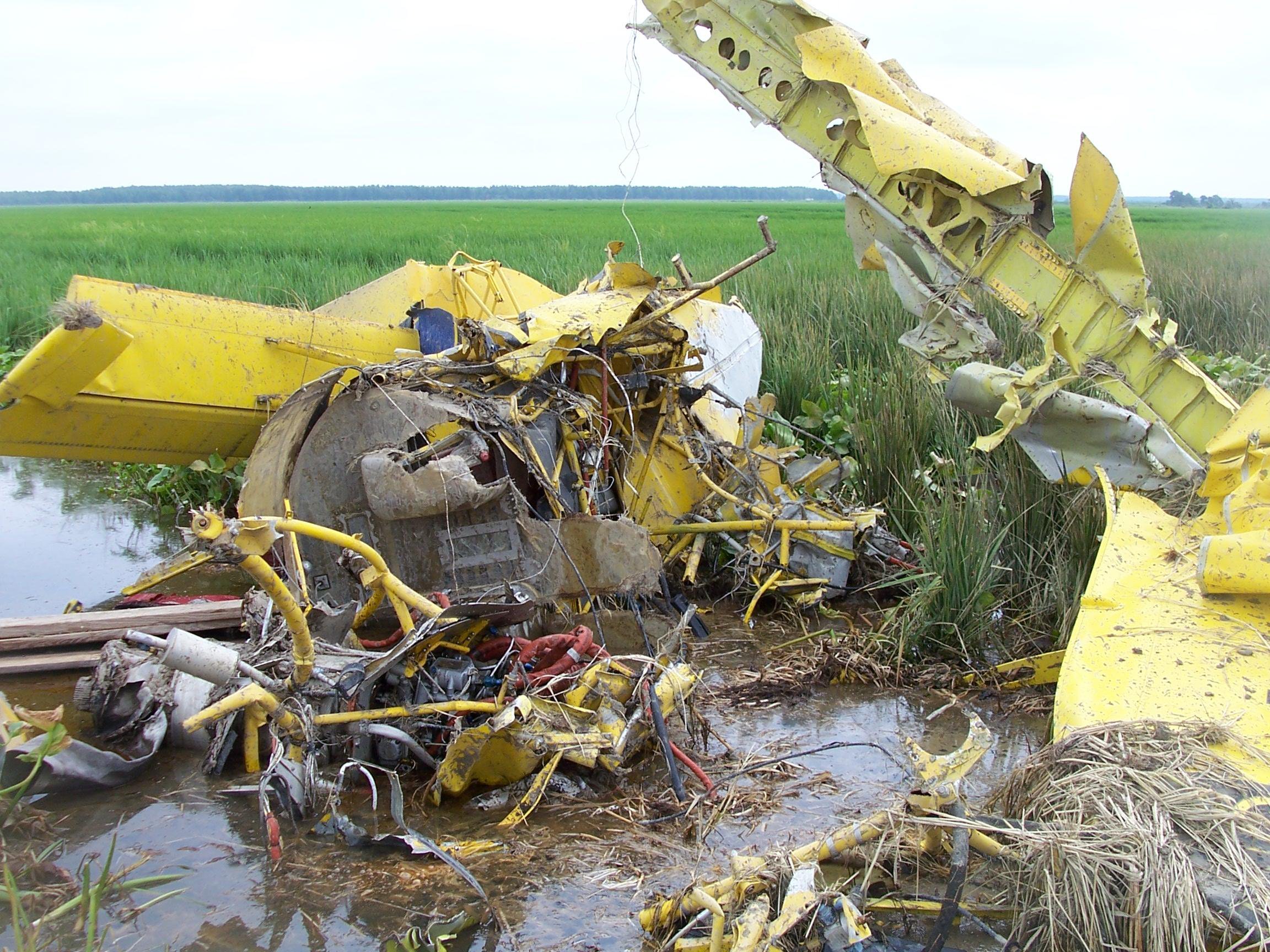
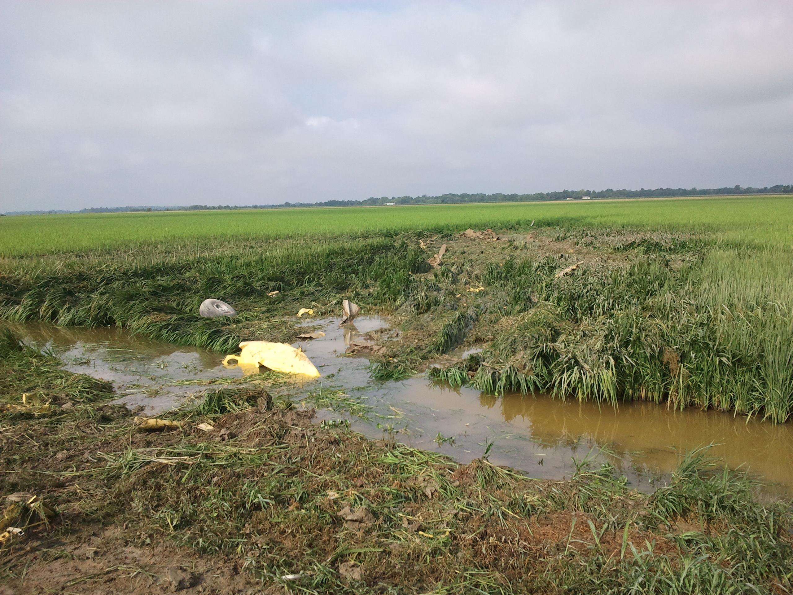
The AT-602 carried a SATLOC GPS unit used for precision aerial application work. The memory card from the unit was recovered and sent to the NTSB Vehicle Recorders Laboratory. The data showed the airplane departing the field site and climbing to about 235 feet above the ground before beginning low-altitude spray passes, altitude varying between roughly 140 and 235 feet above the terrain. The last recorded data points showed the airplane on a westerly track of 280 degrees true, groundspeed of 155 knots, about three-quarters of a mile south of the accident site. The SATLOC clock setting did not reconcile cleanly with witness statements, so the exact sequence cannot be pinned to a precise timeline, but the geometry is consistent with the airplane flying westbound at low altitude in dense fog and impacting the ground in a left-wing-low, nose-down attitude on a magnetic heading of approximately 085 degrees. The debris field ran 249 feet in length.
Investigation Findings
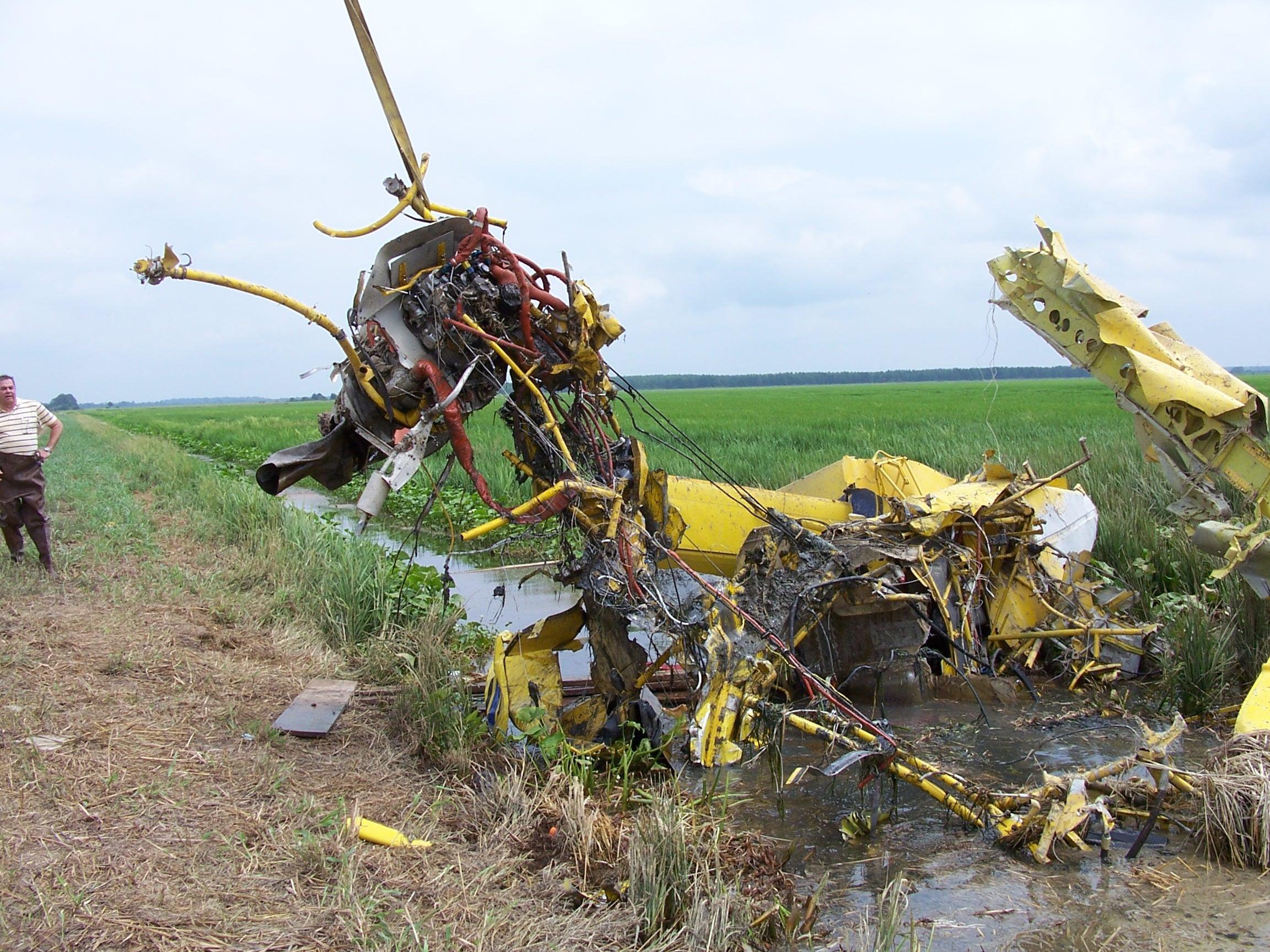
Investigators examined the wreckage thoroughly. The propeller told part of the story on its own: all five blades showed torsional twisting and S-bending, consistent with the engine producing power at impact. One blade had separated from the hub opposite the direction of rotation. The exhaust and combustion sections of the Pratt and Whitney PT6A-60AG showed 45-degree wrinkles around the circumference, the kind of deformation you see when a running engine hits something solid at speed. The engine remained attached to its mounts and all accessories were in place. Every control surface and flight control component that could be examined showed separation features consistent with overload, not preimpact failure. The NTSB found no evidence of any mechanical malfunction or failure that would have prevented normal operation before impact.
The airplane was not equipped for instrument flight. No autopilot, no functioning attitude instrumentation suitable for IMC operations, and critically, the pilot held no instrument rating. He had 17,707 hours, the overwhelming majority of them almost certainly in agricultural work, low and slow over flat Mississippi Delta fields. His last flight review had been December 6, 2010, about seven and a half months before the accident. His second-class medical, issued November 2010, was current. Toxicology showed no carbon monoxide, no cyanide, no ethanol. Amlodipine and benazepril were detected, both used to treat hypertension, both acceptable to the FAA for airmen. There was nothing in the medical or toxicology picture that explained the accident.
What the investigation did establish clearly was the weather environment the pilot entered. The temperature-dew point spread across the region was 2 degrees Fahrenheit or less at multiple stations. The surface-based temperature inversion was trapping moisture below 817 feet above the ground. Agricultural spray operations require the airplane to operate below that altitude, well down in the worst of the fog layer. The AT-602 was not equipped with an emergency locator transmitter. The airplane’s hopper contained no chemicals at the accident site, which may indicate the spray load had been applied or released, but the spray handle mechanism was destroyed and its position could not be determined. What is clear is that sometime during the flight, the pilot lost visual reference with the terrain and the airplane struck the ground.
NTSB Probable Cause
The pilot’s improper decision to conduct a visual flight rules aerial application flight in instrument meteorological conditions, which resulted in an in flight collision with the ground while maneuvering.
Safety Lessons
Agricultural flying is some of the most demanding low-altitude work in aviation. It puts pilots within feet of the terrain on every pass, in aircraft optimized for payload and maneuverability rather than weather penetration. That environment does not leave room for the kinds of margins that get a pilot out of trouble when visual reference disappears.
- A computer weather check is not a weather briefing. There was no record of a formal FSS or DUAT weather briefing for this flight. Company personnel said the pilot checked weather by computer before departing, but whatever that check included, it did not result in a no-go decision. AIRMET Sierra for IFR conditions was active across the state. Greenville was reporting a 100-foot ceiling. The forecast did not expect VFR conditions until 1700. A thorough briefing from those sources, evaluated honestly, leads to one conclusion for a non-instrument-rated pilot operating at treetop altitude.
- No-go decisions have to survive social and economic pressure. The pressure to fly in agricultural operations is real. There are fields to treat, weather windows to exploit, and a business model that depends on hours flown. This pilot had 17,707 hours and had almost certainly operated in marginal weather before without incident. That kind of experience can produce a bias toward continuing, toward believing the conditions are manageable, toward trusting that familiarity with the terrain substitutes for visibility. It does not. When the ceiling is 100 to 200 feet above the ground and forward visibility is measured in hundreds of feet, the terrain does not become visible in time to maneuver away from it.
- Spray altitude and IMC are mutually exclusive. Agricultural application requires operating within tens of feet of the ground, which places the airplane entirely inside the fog layer in conditions like those present on July 26, 2011. There is no instrument procedure that keeps a non-rated pilot safe at 50 feet above a flat Delta rice field in zero-zero fog. The SATLOC data showed the airplane operating between roughly 140 and 235 feet above the terrain during the spray run. At 155 knots groundspeed, with forward visibility of 150 to 200 feet, the pilot had less than one second of visual warning before reaching any obstacle or levee. That is not a margin. That is not recoverable.
Frequently Asked Questions
Q: What is an Air Tractor AT-602 used for?
A: The AT-602 is a single-pilot agricultural aircraft built for aerial application work, primarily crop dusting and spraying. It carries a hopper mounted between the engine firewall and the cockpit, is powered by a Pratt and Whitney PT6A turboprop, and is designed for low-altitude, high-speed pass work over agricultural fields. The airplane involved in this accident was a 2005 model producing 1,050 shaft horsepower through a five-bladed Hartzell propeller.
Q: Can agricultural pilots legally fly in low visibility conditions?
A: Agricultural aerial application operations conducted under 14 CFR Part 137 must still comply with visual flight rules requirements under 14 CFR Part 91. A pilot without an instrument rating cannot legally fly in instrument meteorological conditions, which are generally defined as ceiling below 1,000 feet and visibility below 3 miles. On the morning of this accident, the closest reporting station was showing a ceiling of 100 feet and 1.25 miles visibility — well inside IMC. The pilot was not instrument rated and the airplane was not equipped for IMC flight.
Q: What causes fog in the Mississippi Delta in July?
A: Radiation fog and advection fog in the Mississippi Delta during summer form when overnight temperatures drop enough to bring the air temperature close to the dew point, especially when humidity is already high after hot, humid days. On July 26, 2011, the temperature-dew point spread across the region was 2 degrees Fahrenheit or less, and a surface-based temperature inversion was trapping moisture below about 817 feet above the ground. A moist low-level environment favorable for fog formation was identified in the Jackson upper-air sounding. These conditions produced dense fog that satellite imagery confirmed was sitting over the entire accident area through at least 0745.
Q: What did the SATLOC GPS data show about the flight?
A: The SATLOC unit’s memory card was recovered and analyzed by the NTSB Vehicle Recorders Laboratory. It showed the airplane operating between approximately 140 and 235 feet above the ground during spray pass activity, with the last recorded position about three-quarters of a mile south of the accident site, traveling on a westerly heading of 280 degrees true at a groundspeed of 155 knots. The data ended prematurely for an undetermined reason before the impact. The SATLOC clock setting did not align precisely with witness accounts, so absolute timing could not be confirmed from the data alone.
Q: How does VFR into IMC cause loss of control during agricultural operations?
A: During aerial application, the pilot is already operating at the lowest possible altitudes, sometimes 10 to 50 feet above the crop surface. When fog reduces forward visibility to 150 to 200 feet and the pilot loses visual reference with the terrain, there is no altitude buffer to allow for recovery. Without an instrument rating and without the airplane being equipped for instrument flight, the pilot has no reliable way to maintain spatial orientation or aircraft attitude. The airplane in this accident struck the ground in a left-wing-low, nose-down attitude, consistent with a loss of visual reference and subsequent controlled flight into terrain.