What Happened
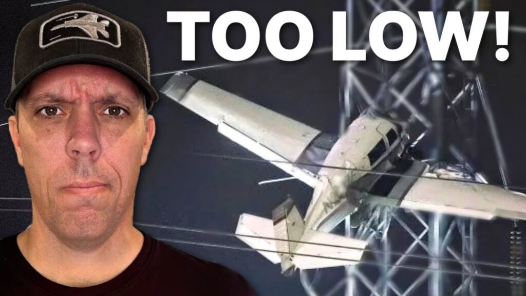
On November 27, 2022, at 5:29 p.m. eastern standard time, Mooney M20J N201RF struck a power-line tower near Gaithersburg, Maryland. The pilot and passenger were seriously injured. The substantially damaged airplane remained suspended in the tower roughly 100 feet above the ground.
The accident occurred on the return flight from White Plains, New York, to Montgomery County Airpark. The pilot was operating on an instrument flight plan in dark-night instrument conditions. The airport reported a 200-foot overcast ceiling and visibility of 1.25 statute miles in fog.
The controller initially told the pilot to expect the RNAV/GPS-A approach. The pilot preferred the RNAV (GPS) runway 14 procedure because the reported weather was below the GPS-A minimums. The controller then attempted to position him for that requested approach.
A direct clearance to the BEGKA intermediate fix did not produce the expected turn. Instead, the airplane turned about 100 degrees right. The controller issued heading changes and additional direct clearances while working to bring the airplane onto the procedure.
The controller also told the pilot that the aircraft ahead had missed the approach and diverted because of the low ceiling. The Mooney continued. Flight data showed that it was consistently below the approach’s published altitude limits and crossed the final approach fix 500 feet below the prescribed altitude.
The pilot later said he saw the ground at 1,200 feet and became focused on keeping it in view through the side window while trying to locate the airport. He continued descending. About 1.25 miles from the runway, left of its centerline, the airplane struck the tower at an elevation of approximately 600 feet mean sea level.
Investigation Findings
The pilot described GPS programming problems during his postaccident interview. He could not clearly explain the features of the installed IFR-certified GPS and said he often used a handheld, VFR-only GPS to avoid the keystrokes needed on the certified unit.
He also said that he had no vertical guidance after intercepting the final approach course. The investigation could not determine whether that absence resulted from how he programmed the procedure or from referring to the VFR-only unit. The report therefore did not establish one specific avionics malfunction or one proven keystroke error.
The minimum altitude depended on which approach capability was available. The procedure’s lowest minimum, 789 feet mean sea level, applied to a category with both lateral and vertical guidance. For an approach with lateral guidance only, the minimum was 980 feet mean sea level. The pilot said he had set an alert for 800 feet despite reporting no vertical guidance.
The accident altitude was lower than either of those minima. At approximately 600 feet mean sea level, the Mooney was only about 61 feet above the airport’s 539-foot elevation, and it was still well short and left of the runway. Airport elevation could not provide clearance over the intervening tower.
The pilot knew the power lines were in the area but believed he was beyond them. That belief did not agree with the airplane’s actual position. The NTSB found that he had become preoccupied with finding the runway visually and had stopped maintaining an effective instrument scan.
Wreckage examination found no pre-impact mechanical anomaly that would have prevented normal operation. The Board attributed the accident to visual flight below the published altitude minimums. The GPS difficulties and outside search explained the approach context, but the measured flight path established the altitude violation that placed the aircraft into the obstacle.
NTSB Probable Cause
The pilot’s visual flight below published altitude minimums, which resulted in collision with a powerline tower structure.
Safety Lessons
The following takeaways apply the investigation findings to flight planning and cockpit decisions.
- Use the minimums for the guidance actually available. Before commencing the final segment, identify the active approach mode and applicable minimums using the approved equipment and procedure. A lower published minimum is not available merely because it appears on the same chart.
- Keep the instrument scan through the visual transition. Seeing ground through a side window is not the same as meeting the required conditions to continue below approach minimums. Maintain the published protection until the transition is valid; otherwise use the applicable missed approach.
- Resolve avionics uncertainty before low-weather arrivals. Practice loading, activating, and confirming approaches in the installed equipment under appropriate training conditions. A handheld display cannot substitute for understanding the equipment on which an instrument approach depends.
Watch the Full Analysis
Frequently Asked Questions
Q: How low was the Mooney at the final approach fix?
A: The NTSB found it was 500 feet below the published minimum altitude at that fix and consistently below prescribed altitudes during the approach.
Q: What were the approach minimums at Gaithersburg?
A: In this investigation, the lowest minimum with lateral and vertical guidance was 789 feet mean sea level. The lateral-only minimum was 980 feet. Those are the historical values in the accident report, not current navigation instructions.
Q: Did a GPS failure cause N201RF to hit the tower?
A: The pilot reported programming difficulties and no vertical guidance, but the reason for the missing guidance was not determined. The NTSB attributed the collision to flight below published altitude minimums.
Sources and References