What Happened
On the morning of March 23, 2014, the pilot of a 1947 de Havilland DHC-1 Super Chipmunk, N540FM, picked up the phone and called Lockheed Martin Flight Service at 0639. He was planning a VFR cross-country from somewhere near Watertown, Wisconsin down to Franklin County Airport in Canon, Georgia, at altitudes between 3,000 and 6,000 feet msl. The briefer did not soften it. There was, he said, a lot of weather. From southern Kentucky through Tennessee and into north Georgia, VFR flight was not recommended. There was an Airmet for mountain obscuration covering that same corridor, valid until 1400. The pilot had heard enough. Near the end of the briefing, he told the briefer he would probably only get down to Kentucky and spend the night.
That is not what happened. The pilot flew south to French Lick Municipal Airport in French Lick, Indiana, touching down around 1039. He bought 30.8 gallons of 100LL, topped off, and at 1209 he departed for Canon, Georgia. He had 16,000 hours of total flight time. He held an airline transport pilot certificate with single-engine land, multi-engine land, and flight engineer ratings. He was employed as a chief pilot for Delta Air Lines. He had owned N540FM since July 1991, flown it to airshows, practiced aerobatics in it, and logged it consistently in his personal logbook through March 11, 2014, twelve days before this flight. He knew the airplane. But the airplane was not equipped for instrument flight. It was not certified for IFR operations. Whatever the weather was going to be between Indiana and Georgia, the Super Chipmunk was going to have to stay underneath it.
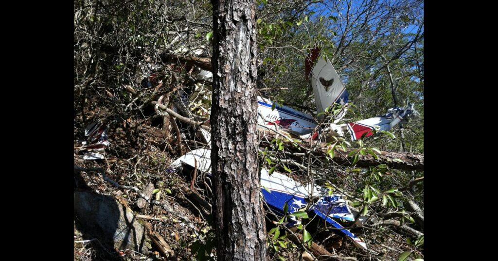
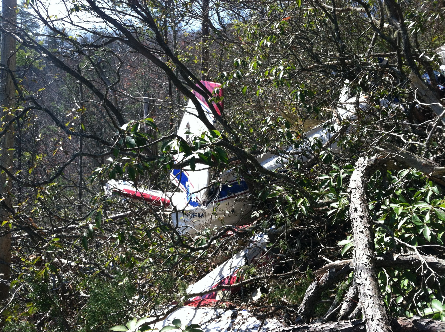
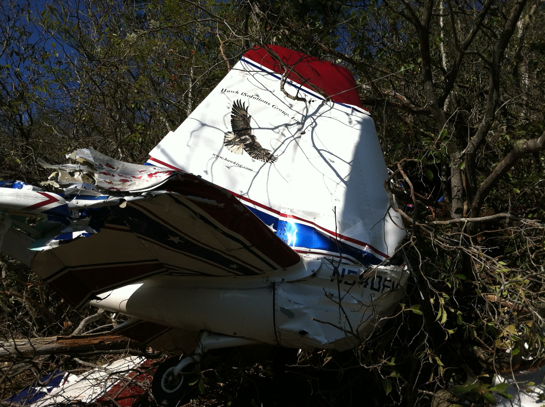
The wreckage was found the following morning, March 24, inside the Cherokee National Forest on the side of a mountainous slope near Vonore, Tennessee. The coordinates put the impact site at about 2,222 feet msl, roughly 100 feet below a ridgeline. The debris path ran on a heading of about 300 degrees. That is northwest. His destination was to the southeast. The damage to the broken trees in the debris path was consistent with a near-level aircraft attitude at impact. No distress calls had been received. No witnesses saw the airplane go in. A local resident in Robbinsville, North Carolina, about 13 nautical miles to the southeast, remembered the afternoon clearly: heavy fog, rain in the mountains, mountaintops not visible from roughly midday until 1530 or 1600. The pilot, age 59, was fatally injured. He was found strapped into the rear cockpit, wearing a parachute that had not been deployed.
The 1324 surface observation at McGhee Tyson Airport in Alcoa, Tennessee, taken six minutes before the accident and located about 20 nautical miles north of the site, showed scattered clouds at 1,700 feet AGL and a broken ceiling at 5,000 feet. Six minutes after the accident, at 1336, the picture had deteriorated: scattered at 1,900 feet, broken at 2,800 feet, broken again at 5,000. NTSB meteorologists reviewed visible satellite imagery from 1345 and found a band of overcast cloud cover stretching along the Tennessee-North Carolina border directly over the accident site. A NAM model sounding identified a saturated layer centered at 3,400 feet msl, with analysis suggesting a broken cloud layer as low as 2,650 feet msl. The ridgeline the airplane hit sat at about 2,322 feet msl. The clouds were sitting on the mountains.
Investigation Findings
Investigators examined the wreckage after it was recovered to a storage facility in Springfield, Tennessee. The engine told a consistent story. Rotating the propeller by hand confirmed crankshaft continuity through to the rear gears and valve train. All six cylinders showed compression and suction. The spark plug electrodes were gray, indicating normal combustion. The fuel injector nozzles were unobstructed. The fuel flow divider diaphragm was undamaged. The engine-driven fuel pump diaphragms and valves showed no anomalies. The oil suction screen was clean. There was oil inside the engine. Nothing pointed to a mechanical failure or pre-impact malfunction. The engine was running when N540FM hit the trees.
The propeller damage told the same story from a different angle. Blade A was splintered from near the hub and broken off about 10 inches outboard. Blade B was splintered and broken at roughly half-span. Blade C was splintered and broken at about two-thirds span. That pattern, combined with the near-level attitude indicated by the tree damage, was consistent with a powered airplane flying into terrain at low speed and low altitude, not a glider falling out of the sky. The engine controls were found in the full-forward positions. Both wing fuel tanks were ruptured on impact and held no residual fuel, but both fuel caps were secure, consistent with fuel being consumed during the flight rather than lost through a leak or improper cap seating.
The airframe examination confirmed control cable continuity from both the elevator and rudder to the cockpit. Aileron continuity could not be established due to wing fragmentation, but all recovered cable sections were attached to their surfaces, showed overstress signatures, or had been cut by recovery personnel during recovery operations. No pre-impact anomaly was identified in the airframe. The toxicology report was negative for carbon monoxide, ethanol, and all tested drugs. The FAA medical record noted one prior DUI arrest in May 2011, with a portable breath test reading of 0.126%, but the pilot had been cleared for continued medical certification with no evidence of alcohol dependence or abuse, and the tox screen confirmed alcohol played no role in this accident.
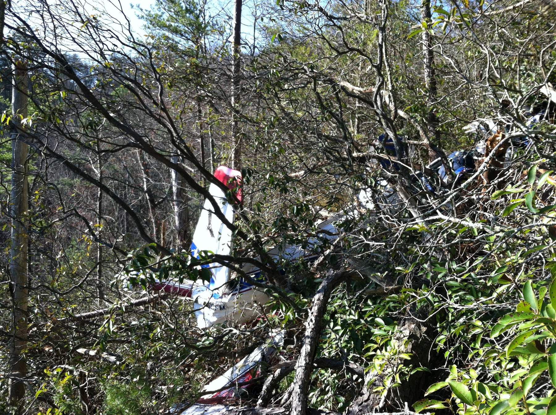
What the investigation could not explain was exactly when the pilot recognized the problem. The debris heading of 300 degrees, northwest, when his destination was to the southeast, suggests he had already turned around. The NTSB analysis noted it was likely that the pilot tried to cross the mountains beneath the cloud cover, found he could not continue in visual conditions, attempted to exit the weather, and flew into the ridgeline during that turn.
NTSB Probable Cause
The pilot’s continued visual flight rules flight into instrument meteorological conditions, which resulted in controlled flight into terrain.
Safety Lessons
This accident is one of the clearest illustrations in the NTSB database of how experience and credentials do not substitute for the go/no-go decision. Three lessons stand out.
- A weather briefing is not a formality. The briefer used direct language: VFR not recommended from southern Kentucky through Tennessee into north Georgia. An Airmet for mountain obscuration was active until 1400. The pilot acknowledged both and said he would stop in Kentucky. Then he departed Indiana at 1209, heading south. The briefing happened. The information was accurate. The pilot had it. And the flight continued anyway. A weather briefing only protects you if the decision-making that follows it matches what the weather actually said.
- Aircraft certification matters in deteriorating conditions. The Super Chipmunk was not IFR certified. It had no vacuum-driven attitude indicator, no IFR-legal avionics fit, no certification for flight in instrument conditions. The pilot held an ATP certificate and flew airliners, so instrument flight was not a capability gap. The aircraft was the limiting factor. When the ceiling started sitting on the ridgelines at 2,650 feet msl and the mountains topped out above 2,200 feet, there was no legal or equipped path through. Flying a non-IFR aircraft into terrain where the clouds are at or below the ridgelines removes every option except turning around before the visibility disappears.
- The turn-back scenario requires altitude and time that mountain terrain does not always provide. The 300-degree debris heading suggests the pilot recognized the problem and initiated a turn toward lower terrain or clearer air. But 100 feet below a ridgeline at 2,222 feet msl is not where that recognition has any value. Mountain flying below cloud layers compresses the decision window dramatically. The point at which the pilot needed to decide to turn back was not when the ridge appeared through the windscreen. It was when the briefer said mountain obscuration and VFR not recommended, or at the latest when the ceiling and terrain began to converge somewhere over southern Kentucky or northern Tennessee.
Frequently Asked Questions
Q: What is VFR into IMC and why is it so dangerous in mountainous terrain?
A: VFR into IMC means a pilot operating under visual flight rules enters conditions where visibility drops below VFR minimums, typically due to clouds, fog, or precipitation. In mountainous terrain, this is particularly lethal because the terrain rises into the clouds, leaving no clear altitude at which a VFR pilot can legally or safely fly. The ridgelines in this accident were at roughly 2,322 feet msl and clouds were as low as 2,650 feet msl, leaving fewer than 400 feet of visible air between the mountaintops and the bases of the lowest cloud layer.
Q: Could an experienced ATP-rated pilot have survived this situation by flying on instruments?
A: Instrument capability requires both a qualified pilot and a properly equipped aircraft. N540FM was not certified for IFR operations, which means it lacked the legally required avionics and vacuum or electrical systems to support instrument flight. Even though the pilot held an ATP certificate and flew instrument-equipped jet airliners, the Super Chipmunk could not legally or safely be flown in IMC. The airplane was the binding constraint, not the pilot’s ratings.
Q: What does an Airmet Sierra for mountain obscuration mean for a VFR flight?
A: An Airmet Sierra is issued when instrument meteorological conditions or mountain obscuration is forecast over a broad area. Mountain obscuration specifically means that clouds, fog, or precipitation are covering the terrain at or above the ridge and peak elevations, making visual navigation at or near terrain level impossible. For a VFR-only aircraft, an active Airmet Sierra for mountain obscuration in the planned route area is a hard stop. In this case, the Airmet covered the pilot’s entire route from southern Kentucky through Tennessee into north Georgia, and the briefer explicitly told the pilot VFR flight was not recommended.
Q: Why was the debris heading pointing northwest if the pilot’s destination was to the southeast?
A: A northwest debris heading when the destination was to the southeast indicates the pilot had reversed course at the time of impact. The NTSB analysis concluded it was likely the pilot recognized he could not continue in visual conditions and attempted to exit the weather by turning back. However, the turn was initiated too close to terrain to complete successfully, and the aircraft struck the ridgeline during the attempted exit.
Q: What is a de Havilland DHC-1 Super Chipmunk?
A: The de Havilland DHC-1 Chipmunk is a two-seat, tandem-cockpit, low-wing trainer designed in the late 1940s. The Super Chipmunk designation typically refers to an airframe that has been modified with a more powerful engine than the original Continental or Gipsy powerplant. N540FM was fitted with a Lycoming IO-540-D4A5 producing 260 horsepower, significantly more than the original design, and was used by its owner for airshows and aerobatic practice. The airplane was a tailwheel design and was not certificated for IFR operations.
Sources and References