What Happened
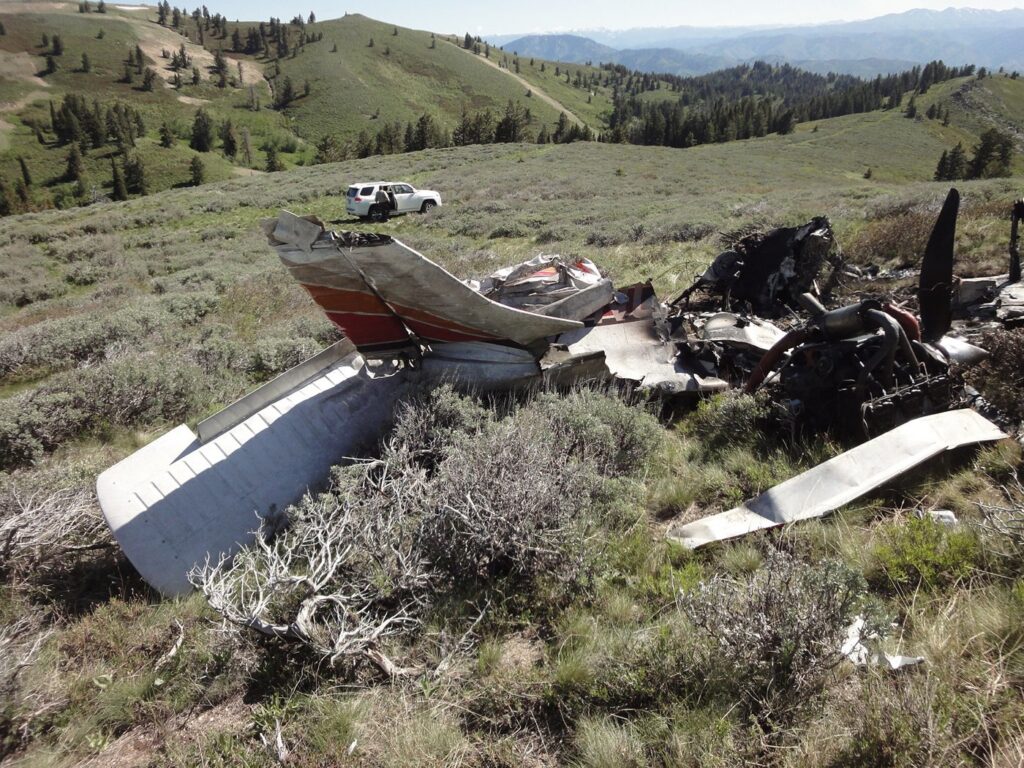
On June 9, 2012, a Piper PA-32-300, registration N8990N, departed Rock Springs, Wyoming, bound for Nampa, Idaho. The 65-year-old private pilot was flying solo on what should have been the final leg of a cross-country flight from Imperial, Nebraska. The flight ended in mountainous terrain near Mountain Home, Idaho, killing the pilot.
The pilot had called his wife from Rock Springs around 9:30 that morning, telling her he was buying fuel for the remainder of the trip. The direct route to Nampa was 290 degrees for 350 nautical miles — a straight shot west across Wyoming and southern Idaho. He filed a VFR flight plan but never activated it. No one heard from him again.
Radar tracked the Piper climbing to 15,500 feet within 30 minutes of takeoff, following a course about 3 to 5 miles north of the direct line. For most of the flight, everything looked normal. The airplane maintained altitude and heading, making good time toward Idaho. But about 25 minutes before the accident, something changed. The radar showed the Cherokee Six descending to 10,700 feet, then continuing down to 7,000 feet by 12:28 PM.
For the next few minutes, the airplane’s altitude varied between 7,400 and 7,800 feet — the pilot seemed to be trying to find a workable altitude. At 12:30 PM, the flight track showed a sharp left turn to an easterly heading. The pilot had reversed course, apparently trying to get out of whatever conditions he’d flown into. But within two minutes, he turned right again, back to the original westbound heading of 290 degrees. The last radar return came at 12:32:39 PM, showing the airplane at 7,600 feet about a quarter-mile southeast of where searchers would later find the wreckage.
Investigation Findings
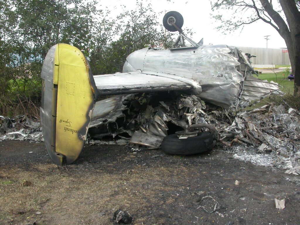
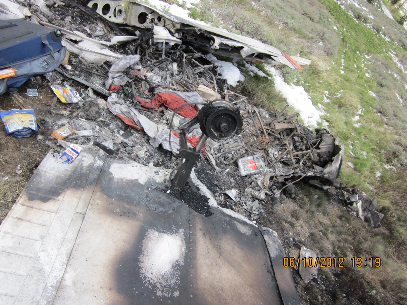
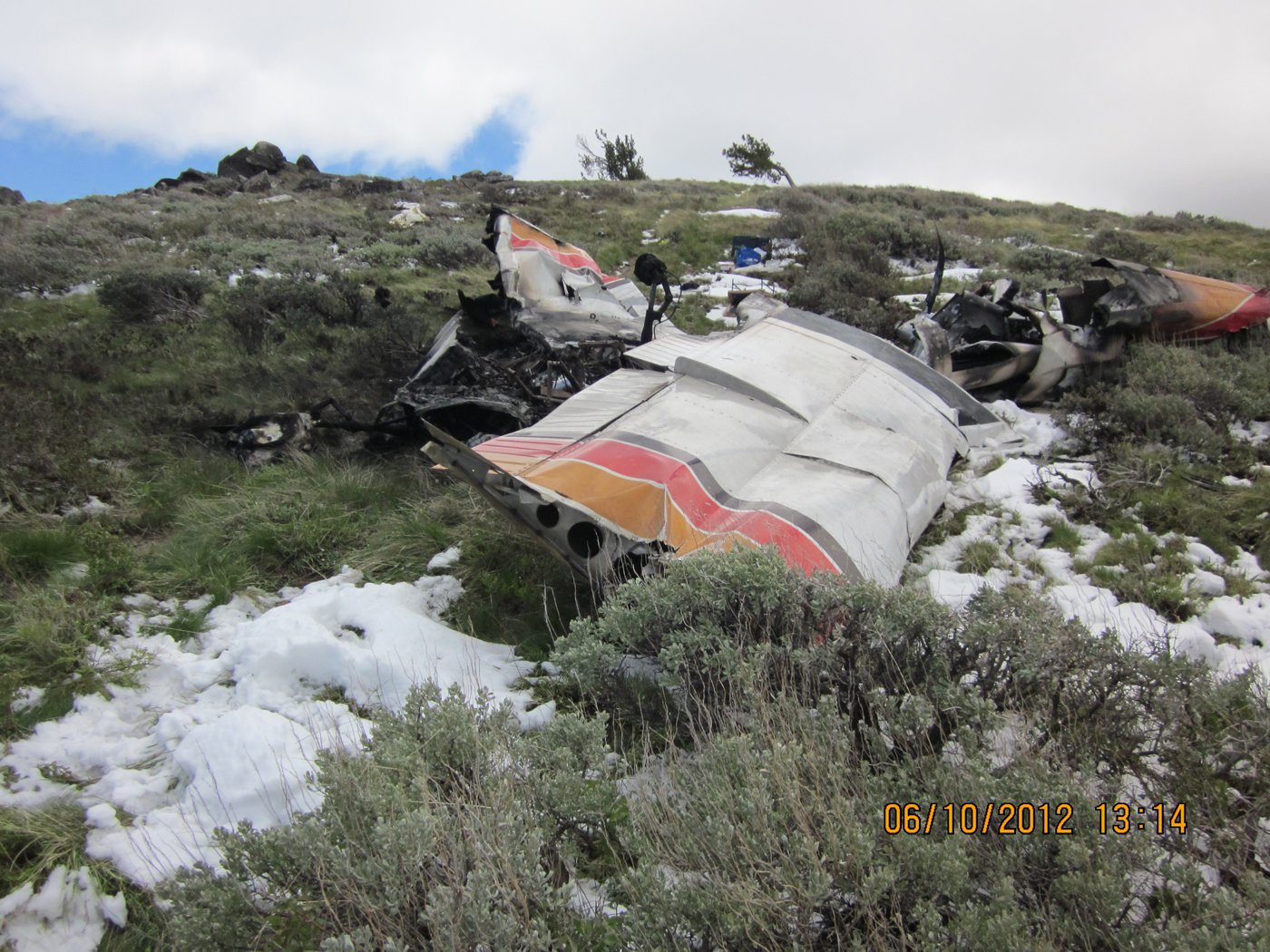
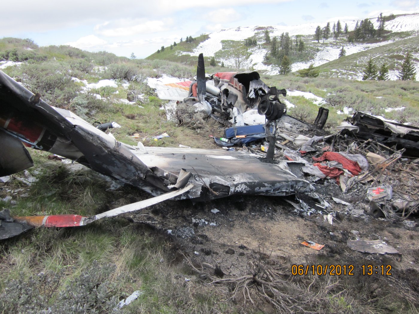
When search and rescue teams located the wreckage that evening, they found 8 to 10 inches of snow on the ground. The airplane had hit mountainous terrain at 7,400 feet elevation in a right-wing-low attitude, leaving a ground scar that stretched 265 feet from initial impact to the main wreckage. The fuselage had come to rest inverted and was consumed by post-impact fire.
The weather told the story. At 12:55 PM — just 23 minutes after the crash — Mountain Home Air Force Base, 28 miles away, was reporting an overcast ceiling at 2,700 feet with light rain and drizzle. National Weather Service radar showed rain and snow showers directly over the accident site at the time of impact. Satellite imagery revealed abundant cloud cover moving west to east with tops between 22,000 and 23,000 feet. An AIRMET was active for mountain obscuration conditions, and the freezing level was right at 7,500 feet — almost exactly where the pilot had been trying to maintain altitude.
The pilot held a private certificate with only a single-engine land rating — no instrument rating. His logbook showed 252 total hours with 82 hours in the previous six months. He’d earned his private license less than two years earlier, in October 2010. The Cherokee Six was well-maintained with a current annual inspection and no mechanical issues. Engine examination revealed normal wear patterns, and investigators found no evidence of any pre-impact mechanical problems that would have prevented normal operation.
NTSB Probable Cause
The noninstrument-rated pilot’s continued visual flight into instrument meteorological conditions, which resulted in controlled flight into mountainous terrain.
Safety Lessons
This accident illustrates how quickly VFR flight can become untenable in mountainous terrain, and how difficult it can be to reverse course once you’re committed. The pilot’s radar track tells a clear story: he encountered deteriorating conditions, tried to find a workable altitude, attempted to turn around, then pressed on anyway.
- Weather briefings are critical, but don’t tell the whole story. The pilot had access to weather information and filed a flight plan, suggesting he’d looked at conditions. But mountain weather changes rapidly, and forecast conditions often don’t match what you’ll actually encounter. Current radar and satellite imagery showed active precipitation and extensive cloud cover over his route, but that information wasn’t available in the cockpit in 2012 like it is today.
- Altitude changes in mountains aren’t always about performance. When the radar showed the Cherokee Six descending from 15,500 to 7,000 feet, it wasn’t because the airplane couldn’t climb. The pilot was trying to stay in VFR conditions below the clouds. But at 7,500 feet — right where he was flying — the freezing level meant he was dealing with snow and icing conditions that his airplane wasn’t equipped to handle.
- The hardest decision is often the right one. The pilot’s initial left turn to reverse course was the correct response to encountering IMC. But continuing that turn and pressing on westbound again proved fatal. Mountain flying leaves little margin for error, and the terrain doesn’t forgive hesitation or second-guessing when conditions deteriorate.
Frequently Asked Questions
Q: What is VFR into IMC and why is it so dangerous?
A: VFR into IMC means a pilot flying under Visual Flight Rules encounters Instrument Meteorological Conditions — weather that requires flying by instruments rather than visual reference. It’s dangerous because pilots without instrument training often lose spatial orientation in clouds, leading to loss of control. In mountainous terrain, there’s the added risk of flying into terrain you can’t see.
Q: Could the pilot have successfully turned around once he encountered the weather?
A: The radar track shows he initially did turn around, reversing course to an easterly heading. This was the correct decision. However, he then turned back toward his destination within two minutes, likely because he could see clear air ahead or thought he could get through the weather. Mountain weather often appears less severe than it actually is.
Q: What altitude should VFR pilots use when crossing mountains?
A: VFR pilots should fly at least 1,000 feet above the highest terrain within a 2-mile radius, but this is a minimum. In mountainous terrain, flying 2,000-3,000 feet above peaks provides better options for emergency landings and helps avoid turbulence and downdrafts. However, higher altitudes increase the likelihood of encountering clouds and icing conditions.
Q: How do pilots detect icing conditions without specialized equipment?
A: Visible moisture (clouds, precipitation) combined with temperatures at or below freezing indicates potential icing. Pilots can estimate freezing level from weather reports and calculate whether their altitude puts them at risk. In this case, the freezing level was 7,500 feet and the pilot was flying between 7,400-7,800 feet, right in the icing zone with visible precipitation.
Q: What should a non-instrument pilot do when encountering unexpected IMC?
A: Execute an immediate 180-degree turn to return to VFR conditions. Don’t try to climb above or descend below clouds unless you’re certain of terrain clearance. If already in IMC, maintain wings level, make gentle turns, and contact ATC immediately for assistance. The key is not to panic and avoid steep turns or rapid altitude changes that can lead to loss of control.