What Happened
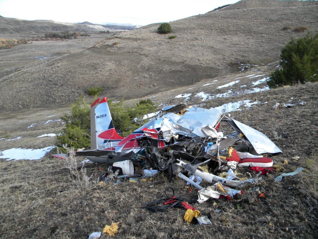
On the morning of October 13, 2009, a 1956 Cessna 182, N6202A, lifted off from Sheridan County Airport in Sheridan, Wyoming at approximately 1100 mountain daylight time. The private pilot, 58 years old, had flown down from Laurel, Montana earlier that morning to get some work done. He and his passenger had departed Laurel at 0700, landed in Sheridan around 0815, and spent a few hours on the ground. When they were ready to head back north, the weather had already been deteriorating for hours. Before they left, the pilot called a family member and told them the return flight was going to take longer than normal. The weather along the route was poor. He knew it. He said so. Then he climbed in and departed anyway.
The route from Sheridan to Laurel runs roughly west-northwest, a straight-line distance of about 80 miles. The terrain in between is not benign. The route crosses the northern edge of the Bighorn Mountains and threads through the valleys and canyon systems of south-central Montana before reaching the Yellowstone River basin near Laurel. The accident site would later be pinpointed approximately 14 miles east-northeast of Pryor, Montana, which put the airplane deep in that canyon country before something went wrong.
Before departure, the pilot had the airplane topped off to capacity. The airport lineman who fueled the Cessna that morning was himself a private pilot. He later told investigators that the weather conditions that day were poor, with limited visibility and cold temperatures. The altimeter at Billings Logan International, about 27 miles northwest of where the airplane would eventually hit the ground, showed an overcast ceiling at 1,000 feet above the airport elevation of 3,652 feet. That put the ceiling at roughly 4,652 feet mean sea level at Billings. AIRMETs Sierra and Zulu were active along the route, flagging mountain obscuration and icing conditions. Search and rescue volunteers who responded the following morning reported that low fog covered the accident site at the time the airplane went down. The pilot was flying a Cessna 182 with 724.3 total hours, in mountainous terrain, in fog, under a ceiling that may or may not have been high enough to clear the canyon walls.
The GPS data recovered from a handheld Garmin unit pulled from the wreckage told the story of the final minutes. For most of the flight, the track ran direct toward Laurel at altitudes between 4,500 and 5,500 feet mean sea level. That was consistent with cruising along beneath or just above the cloud layer, picking a way through. Then, near the end of the recorded data, something changed. The track showed a full 360-degree turn to the right. After completing the circle, the airplane tracked south, then turned 180 degrees back north, then turned south again. The groundspeed data during those last two minutes swung between 72 miles per hour and 182 miles per hour. The second-to-last recorded data point showed 11 miles per hour. The final point showed 139 miles per hour. The last recorded track was westerly. The airplane hit the side of a canyon wall. The pilot and his passenger were both killed. The wreckage was not found until the morning of October 14th, the aerial search having been shut down the previous afternoon because the visibility was too low to search.
Investigation Findings
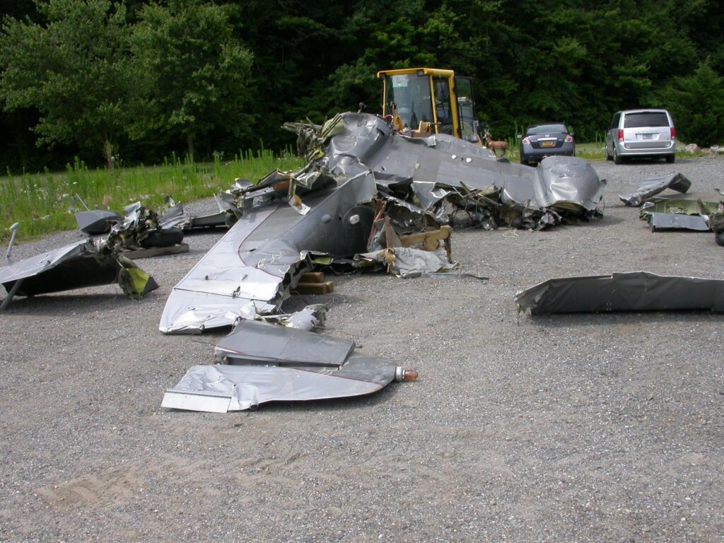
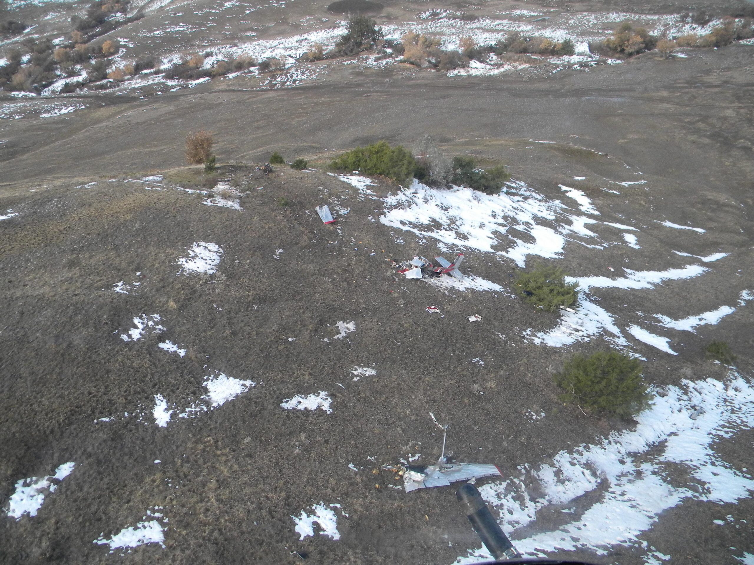
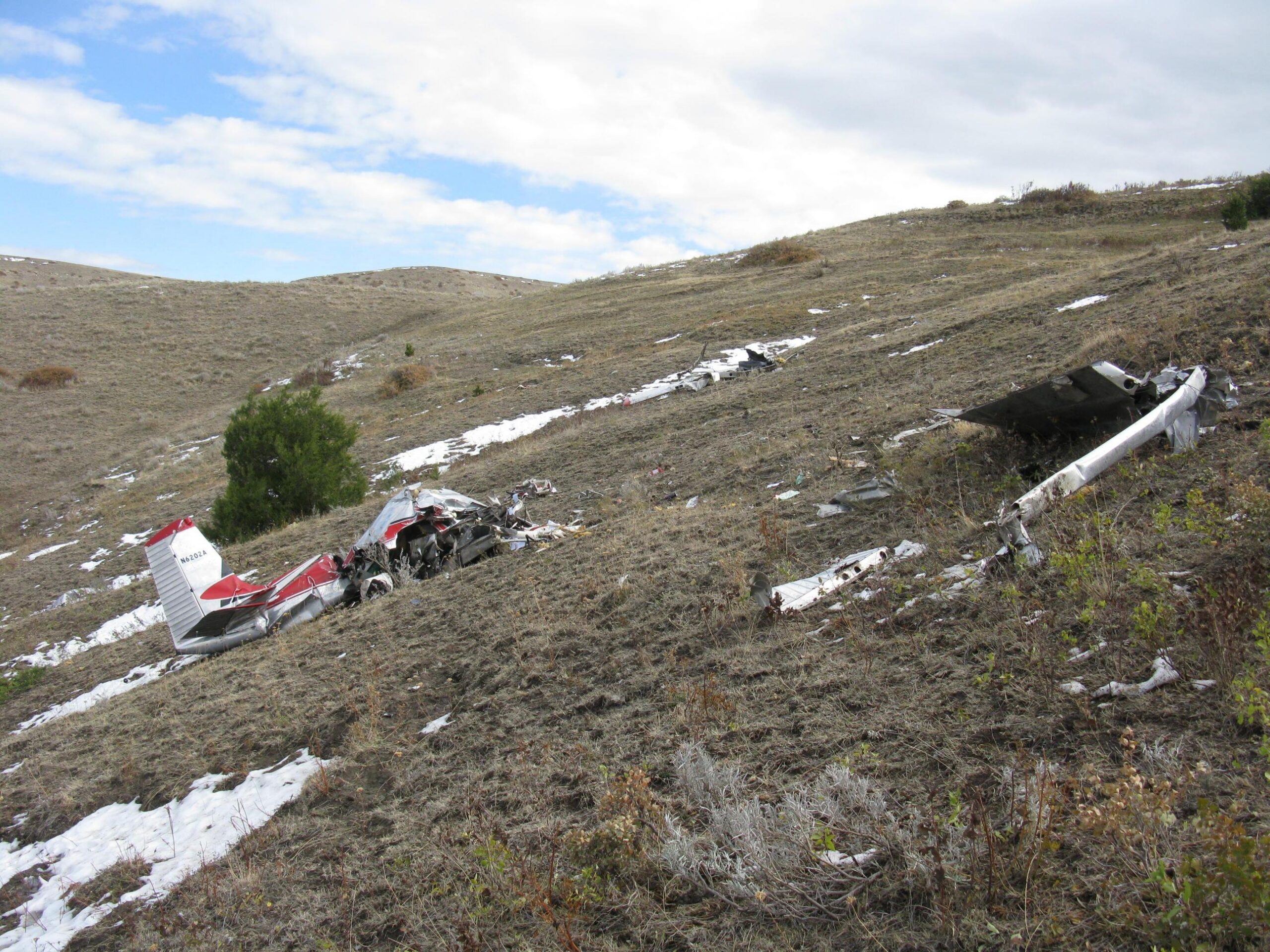
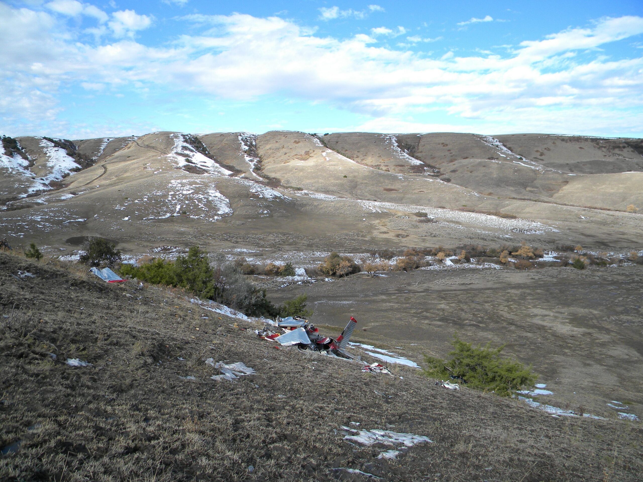
Investigators examined the wreckage thoroughly. The debris field stretched approximately 200 feet along the sloped canyon wall. The first identified point of contact was a line in the dirt leading to a large crater in the earth, and from there the debris path included the engine and firewall, sections of both wings, control surfaces, doors, and seats. The tachometer had frozen at 2,400 RPM. The altimeter read 4,080 feet with the Kollsman window set at 29.92 inches of mercury. The throttle, propeller, and mixture controls were all found in the full forward positions. The fuel selector was positioned between Both and Left, likely displaced by impact forces. The bladder fuel tanks were breached.
The engine examination found no preimpact mechanical anomalies. Gear continuity was confirmed from the propeller assembly through to the idler gear. The spark plugs showed light grey deposits with normal wear. The borescope inspection of the cylinders found light grey deposits on combustion chambers and piston heads, with no abnormal thermal discoloration on the valve heads. One propeller blade was bent aft with its tip bent slightly forward, and the other blade was bent forward. The spinner was crushed around the hub. That propeller signature is consistent with the engine producing power at impact. Nothing about the mechanical examination suggested the airplane had a problem before it hit the terrain. The airplane was flying when it flew into the canyon wall.
The pilot’s records raised additional concerns independent of the weather decision. His last logged flight review was September 9, 2007, when he attended the Montana Department of Aeronautics Mountain Search Pilot Clinic. He attended the same clinic again in September 2009 and accrued 2.7 hours of instruction, but as of 2009 the clinic no longer met the requirements for a flight review under FAR 61.56. Whether the pilot understood that distinction was never determined. No record of a current biennial flight review was found. Beyond the currency question, the instructors who flew with the pilot at both the 2007 and 2009 clinics had documented recommendations that he receive additional flight instruction. His total logged time at the last entry, October 10, 2009, was 724.3 hours in single-engine airplanes, with a private certificate issued in 2004. The airplane itself was last given an annual inspection in October 2008, placing it over a year past its last inspection at the time of the accident.
NTSB Probable Cause
The pilot’s decision to continue flight into an area of low ceilings and low visibility and his failure to maintain clearance from terrain.
Safety Lessons
This accident did not happen because the airplane broke. It did not happen because the weather surprised anyone. The pilot called home before departure and named the problem himself. There are a few things worth sitting with after you walk through what the GPS data showed in those final two minutes.
- A 360-degree turn in deteriorating conditions is a distress signal, not a recovery. The GPS track showed a full circle followed by repeated reversals of direction in the two minutes before impact. That pattern looks like a pilot who has lost visual reference and is trying to find a way out of terrain he can no longer see clearly. A 360 in the mountains under a low ceiling is not a holding maneuver. It is what happens when options are running out. The time to turn around is before you start circling, when you still have energy, altitude, and a known safe direction behind you.
- Groundspeed swings of 72 to 182 mph in two minutes tell a specific story. Those numbers are consistent with a pilot maneuvering aggressively, possibly in a descent, trying to stay visual with terrain that kept disappearing into fog. The airplane was capable of flying straight and level. The conditions it was flying in were not. A 182 cruises around 130 mph. Getting down to 11 mph groundspeed before accelerating back to 139 mph in the final seconds suggests the airplane was nearly stopped in at least one axis while something else was happening. Mountain terrain in fog does not give you time to figure that out.
- Known poor weather before departure is a go/no-go decision, not a planning factor. The pilot did the right thing in calling ahead to say he would be late. That communication showed awareness of the conditions. But awareness of the conditions and a decision to fly in them anyway are two separate things. AIRMETs for mountain obscuration and icing were active. The lineman at the departure airport described the weather as poor. The pilot’s own words to his family confirmed it. A VFR private pilot with 724 hours does not have the training, the equipment, or the currency to manage the conditions that existed along that route on October 13, 2009. The right call was to stay in Sheridan until the weather cleared or to arrange another way back to Laurel.
Frequently Asked Questions
Q: What does the GPS groundspeed data from the final two minutes suggest about what was happening in the cockpit?
A: The groundspeed ranged from 72 mph to 182 mph, with a near-stop at 11 mph just before the final reading of 139 mph. That kind of variation is consistent with aggressive maneuvering, possibly in a steep turn or descent, as the pilot attempted to maintain visual contact with terrain that was obscured by low fog and cloud. It does not indicate a mechanical problem. The engine was producing power at impact, confirmed by the propeller damage signature and the tachometer reading of 2,400 RPM.
Q: Was the pilot current and legal to fly on the day of the accident?
A: That is unclear but concerning. The pilot’s last documented flight review was in September 2007. He attended a Montana Department of Aeronautics clinic again in September 2009 and logged 2.7 hours of dual instruction, but the clinic no longer qualified as a flight review under FAR 61.56 as of 2009. No independent record of a current biennial flight review was found. Whether the pilot was aware the clinic no longer satisfied the requirement could not be determined by investigators.
Q: What weather conditions were present along the route at the time of the accident?
A: The Billings airport, 27 miles northwest of the accident site, reported an overcast ceiling at 1,000 feet above field elevation, or roughly 4,652 feet MSL, at 1153. AIRMETs Sierra (mountain obscuration) and Zulu (icing) were active along the route. Search and rescue volunteers reported low fog covering the accident site at the time of the accident. The pilot was flying through terrain that reaches well above 4,000 feet MSL in an airplane cruising between 4,500 and 5,500 feet MSL, in conditions that were actively obscuring the mountains.
Q: Did the airplane have any mechanical problems that contributed to the accident?
A: No. The NTSB examination found no preimpact mechanical anomalies. Engine gear continuity was confirmed, spark plugs showed normal wear, cylinder borescope was normal, and the propeller damage pattern was consistent with the engine producing power at the moment of impact. The airplane was flying. It flew into terrain.
Q: Why did the 360-degree turn in the GPS track matter to investigators?
A: The 360-degree turn followed by repeated reversals in direction near the end of the flight indicated the pilot was likely disoriented or unable to maintain a clear path through the terrain. In VFR flight through mountainous areas with low ceilings and fog, that kind of maneuvering is a strong indicator that the pilot had lost reliable visual reference and was searching for a safe way out. Investigators noted this pattern when analyzing the GPS data, and it was consistent with the broader picture of a VFR pilot who had continued into instrument meteorological conditions in a canyon environment.